
The UK Met Office confirmed that the exceptional late-June heatwave, which triggered historic three-day Red Extreme Heat warnings and peaked near 39°C, is briefly giving way to cooler, fresher Atlantic air.
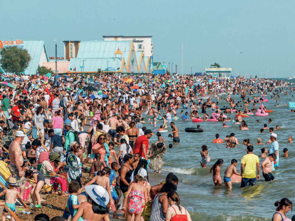
When is Second heatwave? Check New Heatwave, Regional Impact, Timeline, What to Expect & More (Image: Social Media)
UK Heatwave July: Above-average temperatures and hot spells are highly likely to return to the UK in July 2026, following a historic, record-breaking extreme heatwave in late June. The UK Met Office long-range forecast indicates that while cooler Atlantic air is temporarily easing the extreme 39°C June heat, settled, drier, and hotter-than-normal conditions are expected to dominate much of July.
Met Office on UK Heatwave July
The UK Met Office confirmed that the exceptional late-June heatwave, which triggered historic three-day Red Extreme Heat warnings and peaked near 39°C, is briefly giving way to cooler, fresher Atlantic air.
However, this temporary break transitions into a highly mixed and volatile July, driven by a powerful Omega Block weather pattern that continues to pool intense African heat across continental Europe.
UK Heatwave July: Met Office Heatwave July Outlook
A drier start for most regions in early July. Temperatures will remain widely above average, with the south of England holding the highest risk of very warm or hot spells.
High pressure is expected to bring mostly settled and warm conditions in mid to late July, around 9 to 23 July. However, there is a greater-than-normal chance of distinct hot conditions and heatwaves developing at times, punctuated by occasional heavy, thundery showers.
UK Heatwave July: Impact and Safety Guidance
If you are planning outdoor activities or travel in the UK this July, keep these official safety recommendations in mind:
- Check Heat Health Alerts: Monitor regional UK Health Security Agency (UKHSA) warnings, which track potential heat impacts on health, infrastructure, and transport.
- Avoid Peak Sun: Plan outdoor excursions away from the hottest midday hours.
- Water Safety: If visiting the coast or inland lakes to cool off, be aware that sea-surface and open water temperatures remain deceptively cold, presenting a risk of cold water shock. Stay updated with advice from organizations like the RNLI.
UK Heatwave July: Why This Heatwave is Historic
- Consecutive Red Warnings: For the first time in the history of the UK’s weather warning system, Met Office meteorologists issued Red Extreme Heat warnings for three consecutive days.
- Extreme Humidity: Unlike typical dry British heatwaves, this event has brought oppressive tropical-grade humidity, making nighttime temperatures hover above 20°C (tropical nights) and worsening health risks.
- The Drivers: A strong high-pressure system from continental Europe is pulling exceptionally hot air across the English Channel. This is supercharged by broader climate patterns; climatologists note that 2026 is on track to potentially become the hottest year on record globally.
UK Heatwave July: What to Expect
The extreme heat is temporarily shunted east toward the continent, bringing a brief period of relief before the next pattern establishes.
As cooler Atlantic air clashes with residual heat, the Met Office warns of high-impact thunderstorms featuring frequent lightning, sudden downpours, and localized hail.
High daytime heat coupled with elevated humidity has already put immense stress on UK power grids, water supplies, and transport networks.
Continuous hot, dry spells in the south and east are actively raising the risk of localized agricultural drought and wildfires.
Next Heatwave in July in UK
The next major surge in heatwave conditions is most likely to develop between Thursday, 9 July and Thursday, 23 July 2026.
While the current historic June heatwave is breaking down, long-range Met Office data indicates that July will see a rapid return to above-average temperatures.
Next Heatwave in July in UK: Timeline
- 1–8 July (The Interim Window): Temperatures will immediately remain “widely above average,” particularly across the south. Truly extreme heatwave thresholds are unlikely to be hit in this first week as a mixed Atlantic system brings brief periods of rain and cloud.
- 9–23 July (The High-Risk Window): A major ridge of high pressure is expected to rebuild over the UK. The Met Office states there is a “greater than normal chance of hot conditions developing at times” during this two-week block, making it the primary target for the next official heatwave.
The persistent blocking patterns over continental Europe are not fully dissipating. As soon as the current low-pressure system moves away from the UK, the African plume mechanism is expected to resume and drag high-humidity tropical continental air masses right back over the English Channel.



Leave a Reply